R&D Projects
Research & DevelopmentUnderSec
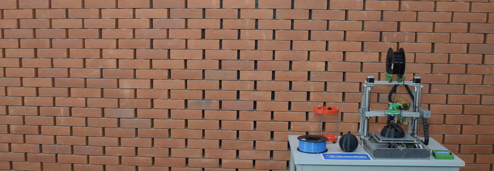
The UnderSec Project, launched on October 1st, 2023, is dedicated to improving maritime security and underwater protection for the smooth transportation of goods and people to and from EU ports. It utilizes advanced technologies and interdisciplinary expertise to enhance situational awareness and response capabilities, with a focus on underwater security.
Maritime security is of utmost importance as it is essential not only for the seamless movement of cargo and passengers in and out of EU ports but also for the protection of crucial maritime facilities along coastlines and rivers. In addition, it is important that ships and maritime infrastructures and the whole marine ecosystem are sufficiently protected against possible illegal acts, by also fostering underwater security to assure secure navigation. The need for a comprehensive approach to underwater security, combining advanced technologies and interdisciplinary expertise to enhance situational awareness and response capabilities is therefore straightforward.
The UnderSec project aims to respond to this need with a multinational and interdisciplinary team of experts in maritime and underwater security. This team includes researchers, academics, and technology experts, as well as end-users from Coast Guard, Border Control, and Port Authorities sectors. The project overall goal is to deter illegal activities and ensure the safety of maritime transportation and critical coastal facilities thanks to a Prototype System, consisting of multimodal sensors and robotic assets, for ships’, ports’ and maritime infrastructures’ Underwater Security Situational Awareness and Decision-Making Support, with relevant Response capabilities.
June 2021 > Ongoing
WAVY-NOS
Drifter Based Nearshore Observation System
WAVY-NOS is a radically new approach to in situ monitoring of littoral areas. Instead of following pre-set trajectories, multiple surface drifters are deployed simultaneously for taking observations with different sensing payloads. Multiple deployments of the drifters, either simultaneous or sequential, will compensate for the uncertainty in drifter trajectories. All data will be stored onboard, but positions and alarms will be sent at a low rate to a Mission Centre via GSM.
OceanScan-MST is responsible for the coordination of this project. WAVY-NOS project is also funded by the EEA Grants, under the Blue Growth Innovation and SMEs (Blue Growth) program operated by the Portuguese Directorate-General for Maritime Policy of the Ministry of the Sea (DGPM).
November 2021 > Ongoing
CoMap
Innovative and cost-effective solution to carry out autonomous bathymetric surveys
The demand for cost-effective solutions to seabed surveys has grown significantly, at the same time as the advance of autonomous systems. Autonomous Underwater Vehicles (AUVs) and Autonomous Surface Vehicles (ASVs) have their respective strengths and weaknesses.
CoMap will combine the strengths of each vehicle type: the ASV’s high position accuracy and the AUV’s capability to gather high resolution sonar data close to the seabed. Using collaborative mapping with ASV and AUV, CoMap offers an innovative solution to the survey market. Sonar data can be gathered more efficiently, with high accuracy and spatial resolution.
The CoMap system proposes the following innovations and advantages:
- A modular multi-vehicle system for bathymetric mapping.
- Dynamic allocation of AUV and ASV for optimal area coverage and efficiency.
- A lightweight multi-vehicle system to reduce Operational Expenditure (OPEX) and Capital Expenditure (CAPEX).
- Low operator footprint.
- Synergistic capabilities arising from coordinated planning and execution control.
CoMap promotes cooperation between enterprises and research institutions in Norway and Portugal, to foster user-driven research-based innovations. This collaboration allows integrations of cutting-edge research into new company products, the sharing of markets and customers, to improve the competitive edge for the involved SMEs. OceanScan-MST is responsible for the coordination of this project.
December 2020 > Ongoing
REMARO
REMARO project solves one of the most pressing problems of modern computing, the safety of AI, in the well-defined context of submarine robotics. In this way, REMARO aims to train fifteen ESRs in order to develop the first-ever underwater robotics AI methods with quantified reliability, correctness specs, models, tests, and analysis & verification methods.
OceanScan-MST’s major role in the project is to provide case study problems, data, and models for ESRs’ research and training program. OMST will also host one of the fifteen ESRs, that will perform a comprehensive risk analysis of a perception of a submarine robot brain, contrasting it with functional safety requirements.
September 2020 > August 2023
ISOLA
ISOLA project combines state-of-the-art technologies blended with novel solutions to enhance the Situational Awareness and support the assigned Ship Security Officer & Crew to the execution of their duties especially to the Ship Security Plan.
In this way, ISOLA aims to develop, integrate, test, deploy, demonstrate and validate a systematic and fully automated security approach by incorporating innovative technologies for sensing, monitoring, data fusion, alarming and reporting real-time during illegal incidents. This will ensure a high level of security among all the passengers of the ship and augmentation of the Ship Security Plan.
OceanScan-MST will be responsible for the data collection for underwater surveillance for external threats and will also participate in the development of the system integration and the platform roadmap, being involved in field demonstrations tasks.

July 2020 > June 2023
ASTRIIS
ASTRIIS (Atlantic Sustainability Through Remote and In-situ Integrated Solutions) is a Portuguese project to support the sustainable growth of the blue economy by developing technical and scientific knowledge for the design, demonstration and implementation of integrated and customizable information products and services.
The project focuses on sectors of the blue economy with high potential for value creation, such as marine renewable energy, aquaculture, coastal tourism, or recreational boating, and is oriented to the needs of users, which include investors, regulators, policymakers, consumers, and scientific researchers.
Currently, there are numerous ocean databases and numerical models for meteo-oceanographic prediction. However, there are still significant knowledge gaps in terms of in situ ocean observations or in solutions based on observations linked to space platforms or aerial sources. Moreover, there is still a lack of infrastructure for a non-specialist operator to aggregate, cross-reference and analyze this significant amount of data in an efficient way for specific purposes.
ASTRIIS intends to fill this gap, breaking the current paradigm based on the dispersion and, sometimes, inexistence of information and knowledge on the marine environment, which is essential for the development of the blue economy and the safeguarding of life and marine resources.
To achieve ASTRIIS objectives, the consortium has designed an offer of information products and services, which emerge from data acquisition through in situ observation and remote sensing, combined with numerical modeling and forecasting. ASTRIIS will also respond to market needs in the context of sustainable and integrated management of the ocean and coastal zones exploitation. In addition, the project will support decision-making processes and enable open digital products to be made available to society at large, with a focus on formal education and ocean literacy.
November 2021 > April 2023 (Completed)
NESTOR
The EU funded project NESTOR addresses a common challenge among EU countries, namely, the protection and safeguarding of the European marine and land borders. To this end, NESTOR aims to demonstrate a fully functional next-generation holistic border surveillance system providing pre-frontier situational awareness beyond maritime and land borders following the concept of the European Integrated Border Management.
The primary objective of NESTOR is to motivate border agencies to capitalize on state-of-the-art technologies for supporting the Member States in reaching full situational awareness at their external borders and enhancing the decision making and reaction capability of their security authorities. Τo this end the project develops a flexible, integrated solution adapted to end-users’ needs and system requirements, combining comprehensive surveillance capabilities, timely pre-frontier situational awareness, and feeds from state of the art sensory devices and off-the-shelf components. NESTOR technologies form an interoperable network to detect, assess and respond to illegal activities in border surveillance missions in both land and maritime operations. The complete NESTOR concept will be assessed in three international trials, that include both land and maritime border operations.
December 2017 > February 2021 (Completed)
MELOA
MELOA offers a solution to extend and improve the current in situ ocean observing and monitoring systems, in the form of WAVY drifter’s devices. The low-cost, sturdy and multi-purpose surface drifters are a new generation of sustainable platforms, easy to embed in different types of marine observation systems.
Running from December 2017 to February 2021, MELOA (Multi-purpose/Multi-sensor Extra Light Oceanography Apparatus) is a H2020 project that is developing an innovative family of products, WAVY drifter units, allowing for a low-cost, easily deployable, high versatility, and low maintenance system for in-situ measurements for marine environments.
Focused on covering marine observation gaps, the WAVYs will increase the availability of in-situ data for coastal and open ocean zones. The MELOA project is developing the first prototypes for the different WAVY units configurations, and engaging with the marine community to test them in different marine environments, collecting and making available the data from the test campaigns and building, on top of this data, the first products and services to showcase the usefulness of the WAVY data.
MELOA Consortium is composed by 10 European entities working in close collaboration with the marine communities to develop solutions that will enable to tackle some societal challenges, namely those related in situ data collection for marine monitoring.
December 2017 > December 2020 (Completed)
OCEANTECH
The OceanTech R&D project is presented as a joint strategic research and development programme, whose main goals include the development of new scientific knowledge, which will allow the advancement, production and delivery of new products, processes and services for deep ocean exploration, which are to be released in the global market.
From this project, eleven new products validated in operational conditions will be produced, which together will make possible the onset of a new service based on the complete integration of marine operations and its control from the shore offering a renewed visibility over them, providing and commercializing information relevant to the Scientific, Industrial and Public end-users.
OceanScan-MST is the leader of two PPSs that aim at developing two products:
- PPS1 – AUV Torpedo: A new generation of modular autonomous underwater vehicles (AUVs) with collaborative operational capabilities. This new generation of AUV torpedo-type vehicles will have a longer battery life to be able to respond to the challenges of subsea exploration in wider distances as well as being capable of operating at greater depths.
- PPS2 – Seafloor Landers: A low cost modular system of landers, fully configurable to harvest seafloor sensor data and support subsea operations. This new generation of data-acquisition fixed platforms will have the capability to be used to up to 3000 metres depth, being developed by making use of new production processes, new materials and optimizing its structure, communication systems and payload management.
April 2017 > September 2019 (Completed)
ENDURANCE
The ENDURANCE project is lead by OceanScan in co-promotion with the Laboratório de Sistemas e Tecnologia Subaquática (LSTS-FEUP) from Porto University.
The project’s main goal is to develop a new and innovative system based on a new generation of AUVs for oceanographic observations over longer periods of time.
OceanScan’s flagship product is the LAUV (Light Autonomous Underwater Vehicle), a platform with the capability to operate autonomously underwater, integrating various sensors and sonars. When configured with the appropriate sensors, the LAUV is a very versatile, efficient and economical tool. The autonomous vehicle can be used for many applications such as oceanographic research, hydrographic surveys, impact assessment of waste water discharges, search and detection of objects and underwater structures, among many others.
Currently, the LAUV has an endurance of up to 24 hours which is practical for bottom mapping applications but not for long-time adaptive surveys. Aiming o extend the range of applications within the reach of this tool, and taking into account today environmental issues, the ENDURANCE project will adapt current-day technology to develop a new and innovative system for oceanographic observations over longer periods of time.
April 2017 > March 2019 (Completed)
“QUALIFICAÇÃO” Project
Since April 1st, 2017 OceanScan-MST is carrying an SME qualification project that aims at strengthening the entrepreneurship capabilities of the company through organizational innovation, applying new organizational methods and processes, and using immaterial investments in the area of competitiveness.
Since April 1st, 2017 OceanScan is carrying an SME qualification project that aims at strengthening the entrepreneurship capabilities of the company through organizational innovation, applying new organizational methods and processes, and using immaterial investments in the area of competitiveness.
Among others, the main objectives of the project are focused on the implementation of a quality management system, the strengthening of the laboratory capacities and the increase of the efficiency of its employees.

March 2015 > February 2019 (Completed)
BRIDGES
BRIDGES project (Bringing together Research and Industry for the Development of Glider Environmental Services) will provide the necessary tool for further understanding of the marine environment, assuring responsable exploitation and long-term preservation. This new ocean glider will support autonomous, long-term in-situ exploration of the deep ocean at large spatio-temporal scales.
The sole European underwater glider, SeaExplorer, will be modularized, new sensors will be developed, and the operational methodology will be modified. The system will be improved by (1) adapting it for a depth rate up to 5000 meters, (2) implementing a novel payload architecture to increase autonomy and to accommodate the range of sensing capabilities needed, and (3) integrating the associated control support system for single and networked operations (mission behaviour, data management, planning, communications). The sensing capabilities will be enhanced and three main sensing modules will be available: (1) for environmental monitoring facilitating the effective implementation of an ecosystem based management under the Marine Strategy Framework Directive, (2) for the oil and gas industry, and (3) for the deep sea mining industry.
The basic premises of the present call “Delivering subsea technologies for new services at sea-BG-06-2014,” are answered thoroughly: the ability to execute unmanned underwater operations, to operate in the deep ocean, and to assess the environmental impact of the maritime economy. In addition, this project will realize and promote the creation of collaborations among sensor and platform manufacturers, oil and gas and mining companies, public health and safety departments, and scientific and engineering experts.
OceanScan-MST will be deeply involved in the development and implementation tasks for the Payload Management system of the glider. Please find more info about the project at http://www.bridges-h2020.eu/
January 2015 > December 2018 (Completed)
RAWFIE
Road-, Air-, and Water- based Future Internet Experimentation is a project funded by the European Commission (H2020) under the FIRE+ initiative that aims to provide research and experimentation facilities for mobile Internet of Things (IoT) devices. The project introduces a unique, mixed experimentation platform across the space and technology dimensions by integrating numerous testbeds for experimentation in vehicular, aerial and maritime environments. RAWFIE is a great opportunity for experimenters to remotely perform experiments on different robotics devices (i.e. UAV, UGV and USV) for assessing the performance networking, sensing and mobile/autonomic domains.
RAWFIE brings together thirteen partner organizations from eight EU countries and organizes two open calls to attract further partners into the consortium, such as: researchers from academia and industry, testbed operators and unmanned vehicles manufacturers.
OceanScan-MST main focus is the manufacture and development of Autonomous Underwater Vehicles and will provide to the project the required team experience and expertise to ensure that the RAWFIE developments (mainly those related with underwater/surface technical challenges) are possible to run on a real world scenarios. Furthermore, OceanScan-MST will disseminate and leverage exploitation of the project results through the participation in exhibitions and fairs related underwater robotics. If you whant to get further information about this project, check the project website at http://www.rawfie.eu/
January 2013 > January 2017 (Completed)
NECSAVE
This project aims to develop, test and evaluate tools and technologies to provide groups (swarms) of heterogeneous unmanned maritime vehicles of Network Enabled Capability (NEC). In this concept, vehicles and operators come and go and interact through inter-operated communication networks, and possibly intermittent, in scenarios where synergies are established that allow the group to do more than the sum of its parts. The project addresses these challenges through a multi-disciplinary approach that relies on advances in:
- Dynamic networks of computer components;
- Design of control architectures for distributed semi-autonomous agents teams;
- Involvement of specialized human operators in the rings of planning and control;
- Fault tolerance;
- Communication networks tolerant connectivity interruptions. It is the project coordinator.
This is an European Defense Agency research & technology project in the field of Unmanned Maritime Systems (UMS) led by the Faculty of Engineering from Porto University and involve partners from Portugal, Spain, Belgium, Italy and Netherlands, namely: Faculdade de Engenharia da Universidade do Porto, APDL – Administração dos Portos do Douro, Leixões e Viana do Castelo, SA; the Portuguese Navy; OceanScan – Marine Systems and Technology, Lda.; Calzoni S.R.L.; Complutense University of Madrid; Royal Military Academy of Belgium and TNO – Netherlands Organisation for Applied Scientific Research. Please find more info about EDA UMS projects at http://www.eda.europa.eu/
April 2010 > March 2015 (Completed)
NOPTILUS
NOPTILUS main objective is to determine – fully-autonomously & in real-time – the AUVs’ trajectories/behavior that maximizes the situation awareness under severe communication, sensing & environmental limitations.
Current multi-AUV systems are far from being capable of fully autonomously taking over real-life complex situation-awareness operations. As such operations require advanced reasoning and decision-making abilities the current designs have to heavily rely on human operators. The involvement of humans, however, is by no means a guarantee of performance; humans can easily be overwhelmed by the information overload, fatigue can act detrimentally to their performance, properly coordinating vehicles actions is hard, and continuous operation is all but impossible. Within NOPTILUS we take the view that an effective fully-autonomous multi-AUV concept/system, is capable of overcoming these shortcomings, by replacing human-operated operations by a fully autonomous one.
To successfully attain this objective, significant advances are required, involving cooperative & cognitive-based communications and sonars (low level), Gaussian Process-based estimation as well as perceptual sensory-motor and learning motion control (medium level), and learning/cognitive-based situation understanding and motion strategies (high level). Of paramount importance is the integration of all these advances and the demonstration of the NOPTILUS system in a realistic environment at the Port of Leixões, utilizing a Team of AUVs that will be operating continuously on a 24hours/7days-a-week basis. As part of this demonstration another important aspect of the NOPTILUS system – that of (near-) optimality – will be shown. Evaluation of the performance of the overall NOPTILUS system will be performed with emphasis on its robustness, dependability, adaptability and flexibility especially when it deals with completely unknown underwater environments and situations “never taught before” and its ability to provide arbitrarily-close-to-the-optimal performance.
January 2010 > December 2012 (Completed)
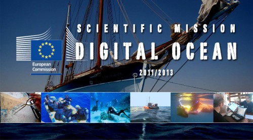
DIGITAL OCEAN
The visionary objective of Digital Ocean is to “open to people connected to the internet, an access to ocean depths, at anytime, anywhere.”
Integrated multimedia mixed reality system, of real time virtual diving, by web tele-operated underwater data collecting robots, diffused online and through a network of submersible simulation devices.
Discovery of ocean depths concerns every one of us. Recent developments of new technologies, of underwater robotic and of GPS are changing dramatically the way people perceive oceans, not anymore from their surfaces, but through their depths, not in immersion but on-line, not deferred but in real time. This is the objective of Digital Ocean. New technologies are now capable of challenging traditional scuba diving by creating an innovative form of diving, based on science and technology, not on bravery – virtual diving in real time. Navigating freely in the oceanic realm, a dream rooted on man’s origins, is now accessible to all. Smart autonomous robots are used to collect underwater digital data that generate sceneries of undersea in 3D interactive imagery. Then, these preprocessed background productions are merged, through mixed reality, with real time 2D videos taken by other distant underwater remote controlled robots teleoperated via the internet, and diffused on-line. As a result, through the web, anyone, anywhere, at any moment – with minimal costs and no risks, will be able to dive virtually in real time, in the most remarkable and secluded sites around the world, unconcerned by sea depths, and get an unmatched quality of images, discover a variety of details, experience the feelings of diving without its constraints and, above all, keeping undisturbed the environment Thus, virtual divers alone or in groups, will be able in few days to discover more than a real diver during all his lifetime. To further enhance virtual diving experience, are integrated in the system a serious video game, a wiki-editing and e-learning platforms, linked with marine specialists. Divers themselves will build their immersed world, keeping virtual sites mirroring real sites, continuously updated and improving in realism. With Digital Ocean, the discovery of the other two thirds of our planet’s immersed territories will become eventually and irreversibly reachable.
Check more info about this project at http://www.virtualdive.com/
May 2008 > May 2011 (Completed)
CON4COORD (C4C)
The project aims at developing control for coordination of distributed systems for five case studies and in regard to control theory, communication networks, and computation.
The case studies are: coordination of under water vehicles, coordination of aerial vehicles, coordination of automated guided vehicles, coordination of a distributed complex machine, and design of a hierarchical control and command system for a motorway network.
OceanScan-MST contribution: develop and make available underwater vehicles capable to test the developed control distributed systems. Read more about the project results in this book.
January 2009 > December 2010 (Completed)
XTREME
Since its foundation, OceanScan – Marine Systems & Technology has focused on marketing a new and revolutionary technology for underwater data collection – the LAUV (Light Autonomous Underwater Vehicles). These vehicles may be seen as platforms capable of navigation in underwater environment. They can incorporate various types of sensors and sonars with multiple applications on the wide spectrum of underwater sciences. The term “Light” is related with its key features: reduced weight and size, ease of operation and low equipment cost, thus providing a simple and economical tool for the study and monitoring of water resources.
OceanScan-MST contribution: With the support of the QREN incentives, using the Xtreme project, OceanScan is now preparing a new series of vehicles with significant improvements in term of: mechanical reliability and efficiency, navigational results and capabilities for obstacles detection and avoidance.